Posts

Showing posts from January, 2018

Planning Phase 2...

Image
As the new semester approaches, we had a planning meeting to work out the details of the next phase of this project. We have decided to do two week units with each of the three pods of Grade 8's to allow us time and flexibility for adjustments as needed along the way. We will be starting with the first pod in the first two weeks of February. The Social Studies class will be rolling out the unit which will begin with a scavenger hunt to examine parts of the school culture and community. From the scavenger hunt we hope themes will emerge that the groups of students will pursue as the focus for their video project. The students will then be doing research and storyboards to map out their video segments. They will be giving a few lessons to plan and then a few more to film. We will be using iMovie primarily and they will upload their videos to Dropbox. When the videos have been compiled, the yearbook class will take the project to the next phase, which will be to create one video b...
Wrapping up Phase 1...

Image
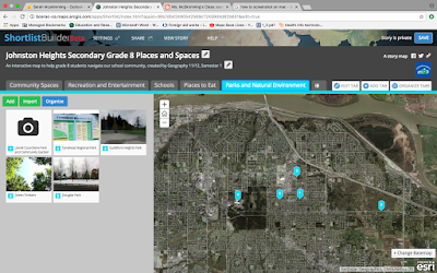
As the first semester comes to an end, the students in Geography 12 have completed their component of this project. I asked the teacher to share some of her reflections with me: The students used ArcGIS software primarily, which is a GIS based learning program designed for schools, businesses and government agencies. It allows these groups to create number of different web-based mapping applications without knowing how to program (ArcGIS does the programming for you through the template). The students in Geography 12 used Story Maps as the template which is the most popular one for schools, but there are a number of other templates to choose from. The City of Surrey trainers worked with the students to help us make the app. Currently, the City uses COSMOS, but are also creating some of the apps in ArcGIS. Any open spatial data from municipalities can be uploaded and mapped using ArcGIS. Students can add in their own data and map it out. The maps that our students created will be upl...