Wrapping up Phase 1...
As the first semester comes to an end, the students in Geography 12 have completed their component of this project. I asked the teacher to share some of her reflections with me:
Some challenges that we ran into are that
multiple accounts cannot collaborate on the same app, so students used the teacher account to create their points on the map app. Also, if the students forget
their username or password we had to email someone in Toronto to get it reset. Having said that, the app was quite user-friendly and students were able to map their points quite easily. Here are a few examples:
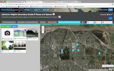


The students used ArcGIS software primarily, which is a GIS based
learning program designed for schools, businesses and government agencies. It
allows these groups to create number of different web-based mapping applications
without knowing how to program (ArcGIS does the programming for you through the
template). The students in Geography 12 used Story Maps as the template which is the most popular one for schools, but there are a number
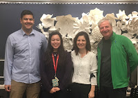
of other templates to choose from. The City of Surrey trainers worked with the
students to help us make the app. Currently, the City uses COSMOS, but are also
creating some of the apps in ArcGIS. Any open spatial data
from municipalities can be uploaded and mapped using ArcGIS. Students can add
in their own data and map it out. The maps that our students created will be uploaded to the City site soon


Comments
Post a Comment