Posts

Final Report

Project Final Report General Description Vision and Goals The vision was for grade 8 students to explore the school community of Johnston Heights Secondary both as it is in the present and some of its history and communicate that in a welcome video for future students. Johnston Heights Secondary is an IB world school. The IB program believes in action and service as integral parts of the program. (IBO, 2017) We felt that this project would enable students to take action by applying their learning in making a positive impact the future students of the Johnston Heights community. The goals were:  1. To have to find their sense of place in the school and local community. In doing so, the goal is to give students a context in which they will create a vision for their own contributions to the community as they continue on as Johnston Heights students and future citizens of the community.  2. To have students explore and understand their school history and local community.

Project Update and Project Outcome Report

Our second pod of Grade 8 students is in the middle of filming and editing their videos this week. We feel like it has gone more smoothly with some of the tweaks we made with the process that we learned from last time. We were able to better use the Go-Pro cameras. More time was spent on teaching the editing with a short practice run before the students went off to film. We also had the students focus more on informational/journalistic style videos rather than skits or scenes. We hope that some of these changes will produce better footage for us to use in our final video. The Yearbook class is set to take over in May to put the best videos together into a compilation which will form our final product for this project.  In terms of the Project Outcome Report, we have been collecting feedback from the students and teachers involved to include in the report. I have sent out some reflection questions to the teachers to use with the students. Some examples are: 1. What did you learn abo

Artifact #2 Scavenger Hunt & Instagram Photos

Image
T he Grade 8 students in Yellow Pod completed the first round of this project. They explored the school with a scavenger hunt and pulled out themes based on what they found. Their inquiry question was “When you started at JH, what do you wish you had known?”. To answer this question they had to research their chosen theme and create an informational video for incoming students. We finished off the unit this week with a film festival in the theatre to showcase their videos. They did a great job with a tight timeline under the direction of Clara Salja and Aaron Vick.  The SET-BC team met today to reflect on the process and make adjustments for the next group. The information is based on the self-reflection the students did as well as Clara's reflection on the process from the teacher's perspective. Here is what we found: Students were very engaged with the process and were committed to finishing their videos. We think it is because they were going to have them showcas

Artifact #1 Geography 11/12 ARC GIS Community Mapping Project

Image

Assessment

Image
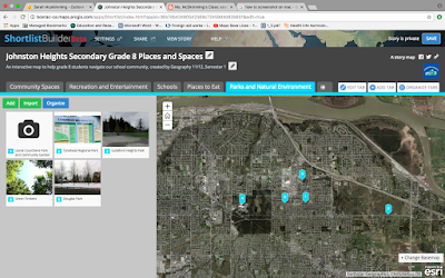
The senior students who completed the GIS mapping portion of our project were assessed using both formative and summative assessment tools. During this phase of the project, Sarah, our Geo 11/12 teacher monitored the students' progress as she was able to check on them from her own GIS account. At the end, they were assessed on the quality of the maps they created. She also did self-reflection on the process with them. They were also able to evaluate the app in terms of ease of use, etc. Most found that it was easy to plot points and upload information using the template that the app provided. It was a bit frustrating that it all had to be done under the teacher's account, but at the same time it allowed Sarah to closely monitor the project. As we move into the next phase of our project with the junior students, we will be using again both formative and summative assessment tools. For the formative, students will be asked to self-reflect along the way. They will also have chec

Planning Phase 2...

Image
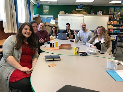
As the new semester approaches, we had a planning meeting to work out the details of the next phase of this project. We have decided to do two week units with each of the three pods of Grade 8's to allow us time and flexibility for adjustments as needed along the way. We will be starting with the first pod in the first two weeks of February. The Social Studies class will be rolling out the unit which will begin with a scavenger hunt to examine parts of the school culture and community. From the scavenger hunt we hope themes will emerge that the groups of students will pursue as the focus for their video project. The students will then be doing research and storyboards to map out their video segments. They will be giving a few lessons to plan and then a few more to film. We will be using iMovie primarily and they will upload their videos to Dropbox. When the videos have been compiled, the yearbook class will take the project to the next phase, which will be to create one video b

Wrapping up Phase 1...

Image
As the first semester comes to an end, the students in Geography 12 have completed their component of this project. I asked the teacher to share some of her reflections with me: The students used ArcGIS software primarily, which is a GIS based learning program designed for schools, businesses and government agencies. It allows these groups to create number of different web-based mapping applications without knowing how to program (ArcGIS does the programming for you through the template). The students in Geography 12 used Story Maps as the template which is the most popular one for schools, but there are a number of other templates to choose from. The City of Surrey trainers worked with the students to help us make the app. Currently, the City uses COSMOS, but are also creating some of the apps in ArcGIS. Any open spatial data from municipalities can be uploaded and mapped using ArcGIS. Students can add in their own data and map it out. The maps that our students created will be upl